As I mentioned in my last post, the pack and I finally decided to make the leap and move to Alaska. It’s been a long-time dream of ours, and we knew it would happen eventually, but it wasn’t until Nathan got a job in Anchorage that it suddenly became a reality. Because I didn’t feel comfortable flying with the dogs as cargo (that’s the only downside of having large dogs!), it quickly became clear that I would have to make the drive from Snohomish to Anchorage . . . a distance of roughly 2,250 miles. Fortunately for me, my good friend Michelle—who hiked the John Muir Trail with me and had moved to Alaska from the east coast just over a year ago—volunteered to fly down to Seattle and accompany me on the journey up North. So I picked her up at the airport late on Sunday evening and we spent one last night at home with my family. I am so fortunate to have grown up in such a special place and to have such a close relationship with my family, but that also made for a very difficult goodbye.

 The next morning was hectic and emotional, as you can imagine. I finished some last minute packing and scrambled to fit everything in Sir Pumpkin (my little orange Subaru). After a few prolonged hugs and tear-filled goodbyes, we began the long drive North. It was an unusually warm Spring day, and the familiar peaks of the Cascades looked as stunning as ever as we headed North on I-5. Part of me questioned why I was leaving a place I love so much, but I also knew I had to at least experience life in Alaska or I’d regret it forever.
Aside from a few questions at the border about our bear spray (apparently it’s fine as long as the label says it’s intended for bears, which seems a bit odd to me), we made it in to Canada without any trouble. Within an hour we were cruising through beautiful British Columbia.
Michelle had assured my parents before we left that we couldn’t possibly get lost, and so naturally we somehow made a wrong turn on our first day of the trip. Before long, we had left the lush green landscape that engulfs the main route and found ourselves driving on unnamed roads surrounded by dry, barren hills that stretched as far as the eye could see. It became very clear this was not a road intended for tourists when we passed an enormous open pit mine, which had stripped the landscape and rendered miles upon miles of the earth completely unrecognizable. While it was eye opening to see this lesser-known side of B.C., we were relieved when we finally rejoined the main highway several hours later.
As the sun began to set, we took a small detour to Marble Canyon, where we spent our first night camped on the shore of a beautiful lake surrounded by rugged cliffs on all sides.
As we headed East along Highway 16 the next morning, the scenery immediately began to change: the towns became less frequent, the mountains continued getting bigger, and the wilderness just  seemed more, well, wild. It started drizzling by the time we reached the picturesque ski-town of Smithers, B.C., so we decided to stay in a hotel to avoid having wet camping gear for the remainder of the trip. The sky was mostly clear the following morning, and after enjoying a delicious breakfast at the hotel restaurant, we enjoyed panoramic views of the hanging glacier above town. I took a mental note that, if U.S. politics ever drive me to leave the country and move to Canada, Smithers would be a pretty good candidate.
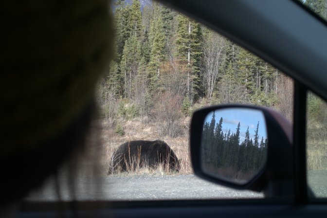
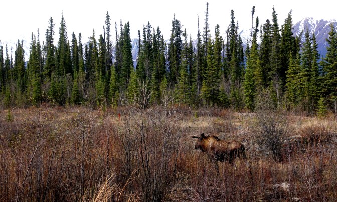
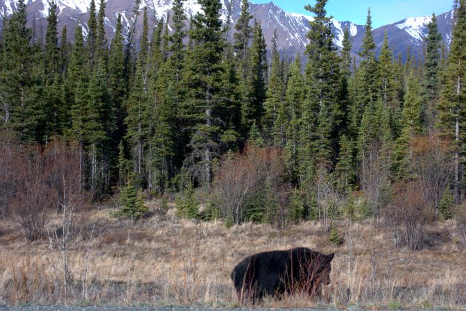
A few hours later, we were heading North on the Cassiar Highway—the northwesternmost route through British Columbia to the Yukon. This remote, 450 mile long road is an alternative to the Alaska-Canada Highway, and known for its breathtaking scenery. The guidebooks had promised ample wildlife viewing, and they did not dissapoint. Within a mile after we turned onto the Cassiar, we saw a black bear munching on grass alongside the road.
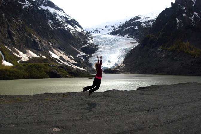
We were making good time, so we decided to take a side trip to the coastal towns of Stuart, B.C., and Hyder, Alaska. This 40-mile spur road winds through a narrow mountain valley, and offers stunning glacier views. The Bear Glacier, in particular, provided the perfect photo op.


Compared to Hyder (population 87), Stuart, B.C. (population 494) is a booming metropolis. We stopped at a quaint little gift shop in Hyder, where we felt obligated to support the local economy by purchasing a souvenir. We had a long chat with the owner, and I was relieved to learn that this sleeping little town is actually filled with hoards of tourists during the summer.
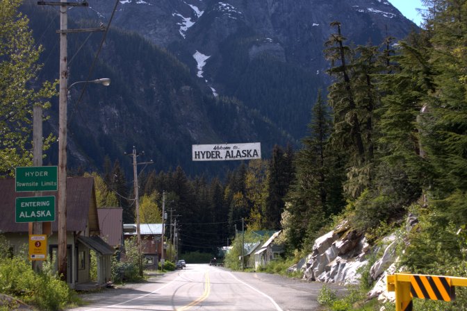
After exploring the rest of the town (which took no more than five minutes), we headed back into Canada. At the Canadian border station (the U.S. apparently decided it wasn’t worth having one there), we were questioned yet again about our bear spray. We assured the officer that it was indeed labeled for use in deterring bears, and he sent us on our way. Phew. We realized afterwards how irritating it would have been had they confiscated any of our belongings after our 45 minute trip abroad.
That night, we stayed at a beautiful campground on Meziadin Lake, which had been closed for the season until the day before we arrived.
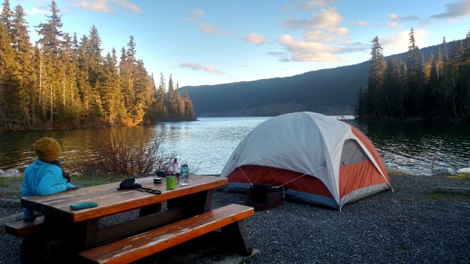
After dinner, we took a walk around the campground and met two other campers who were also moving to Anchorage. Looking back, it shouldn’t have been so surprising given that most people probably wouldn’t choose to make such a long drive unless they were moving to or from Alaska. I guess that explains why such a large percentage of the relatively few vehicles we encountered on the journey were U-Hauls!
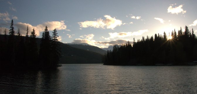
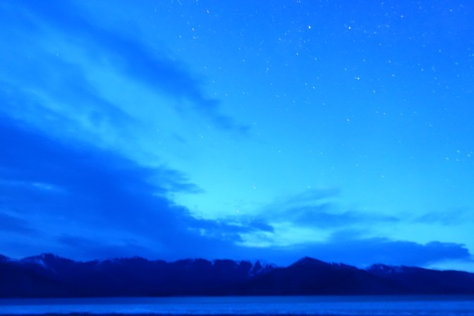
We watched the sun set over the lake and then crawled into the tent. In the middle of the night, after the dogs woke me up, I decided to get out and take some star pictures.
![]()
I was pleased with how they were turning out. The night was crisp and cold, and the sky was crystal clear. Although I’d been facing the lake, when I turned around I noticed a hazy light low on the horizon. When I realized the lights were coming from the North, I was ecstatic. I spent the next hour standing outside in the freezing cold capturing the auroras as they danced across the sky. Because we were traveling farther North and the days were getting longer, I knew this might be the last time I’d get to see them until after summer.
![]()
The next day, we crossed from British Columbia into the Yukon, and I witnessed a new type of wilderness that is unlike any I’d ever experienced in my life up until that point. My parents took us on a trip up to the Arctic Circle when I was little, but I was too young to understand what I was really seeing. What I noticed as we drove deeper into the Yukon Territory was a different kind of “wilderness”—one that was breathtaking and beautiful, sure, but was also wild in a true, genuine sense. It’s the kind of wild that seems to subtly exist beyond the average explorer’s purview, that’s so big in every way it’s almost hostile and incomprehensible to every one and every thing not innately a part of it. The land itself and the creatures that call it home were blatantly indifferent to us as we passed through, almost as if they were blind to our very presence in their expansive northern landscape.
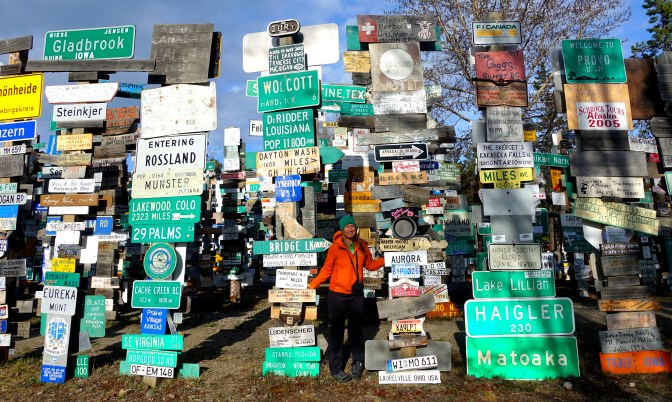
That evening, we finally reached the end of the Cassiar Highway. Before heading West towards the Alaskan border, we decided to make a small detour Watson Lake. We got a room at one of the only hotels in the area and then took a walk through this strange little town. I’m not sure what felt so odd about Watson Lake—maybe it was the emptiness of the gravel streets and parking lots, which seemed out of place compared to how vibrant the storefronts appear to visitors at first glance.
Watson Lake’s most distinguishing feature is the Signpost Forest located in the center of town—a seemingly endless collection of signs, license plates, and placards affixed to wooden posts, brought by travelers from all corners of the globe.
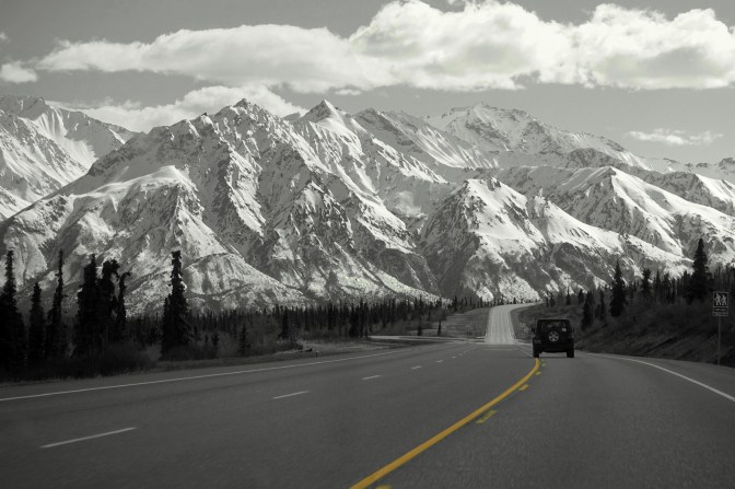
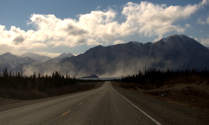
The next day, we began heading west on the Alaska Highway. Aside from passing through the outskirts of Whitehorse, we saw very few signs of civilization as we drove through vast Yukon landscape. As the afternoon turned into evening, we caught sight of the snow-clad Wrangell Mountains to the west. The Wrangells, located in eastern Alaska, contain 12 of the 40+ Alaskan peaks over 13,000 feet, and are spectacular, to say the least.
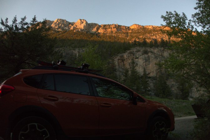
We soon reached Kluane Lake, our destination for the night. As we approached the lake, a dust storm came rushing in from the west, giving it an eerie feel. It didn’t help that Kluane Provincial Park was still closed for the season, and therefore we were the only ones for miles around.
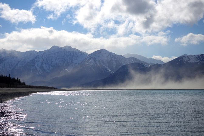
We found a dirt road leading down to the shore of the lake and, because all of the campgrounds were closed, we parked on the rocky beach for the night. We knew that grizzly bears are common in the area, so we decided to sleep in the back of my Subaru. It was quite cozy, if not a bit cramped with the four of us. I set my alarm several times in the middle of the night, hoping to catch some more photos of the northern lights. I quickly realized, however, that we had traveled too far north by this point. Until my next trip down to Seattle, I wouldn’t experience real darkness for many months.
We woke up early the next morning to begin the final stretch to Anchorage, which we figured would take us about 14 hours of driving. On that last day, the miles passed by very slowly. After we crossed the border in to Alaska, I knew I was almost home and I could hardly contain my excitement. The mountains kept getting bigger and bigger as we drove, and soon Michelle pointed to an impressive range in the distance. This was my first glimpse of the Chugach Range, which borders the city of Anchorage. I would soon become intimately familiar with these mountains. We had made it.