The pack and I have successfully completed the first section of our PCT hike, covering roughly 112 miles. I am currently sitting in the cozy Timberland Library in the quaint little logging town of Packwood, Washington. It is pouring down rain outside, our feet (and paws) are aching, and we are taking a much-needed rest day. As promised, I’m here to give an update of the highs and lows (literally and figuratively) of our journey thus far.
Part 1: Bridge of the Gods to White Pass
Okay, okay. We cheated. Although the first section of the Washington PCT technically begins at the Bridge of the Gods on the Columbia River, several of the guidebooks I read suggested the first 35 miles might be worth skipping because they are not only miserably hot and steep, but also travel alongside roads much of the time and therefore lack any redeeming scenic qualities. So we did just that. One thing I’ve learned over the past ten days on the trail is that—unlike the countless “thru-hikers” we’ve encountered, who have walked all of the way from the Mexican border—we “section hikers” can afford to be picky. So instead of starting at Cascade Locks, we began our trek at the lush, forested campground at Panther Creek.
From Panther Creek, we entered the Wind River experimental forest, whose enormous Douglas fir and Western hemlock transformed the wind rustling through their uppermost branches into the sound of a giant, gushing river. We then traveled through the Indian Heaven Wilderness, which I had never heard of but which is a beautiful area characterized by huckleberry-filled forests, rolling hills, and occasional views of Mount Hood to the south and Mount Adams to the north.
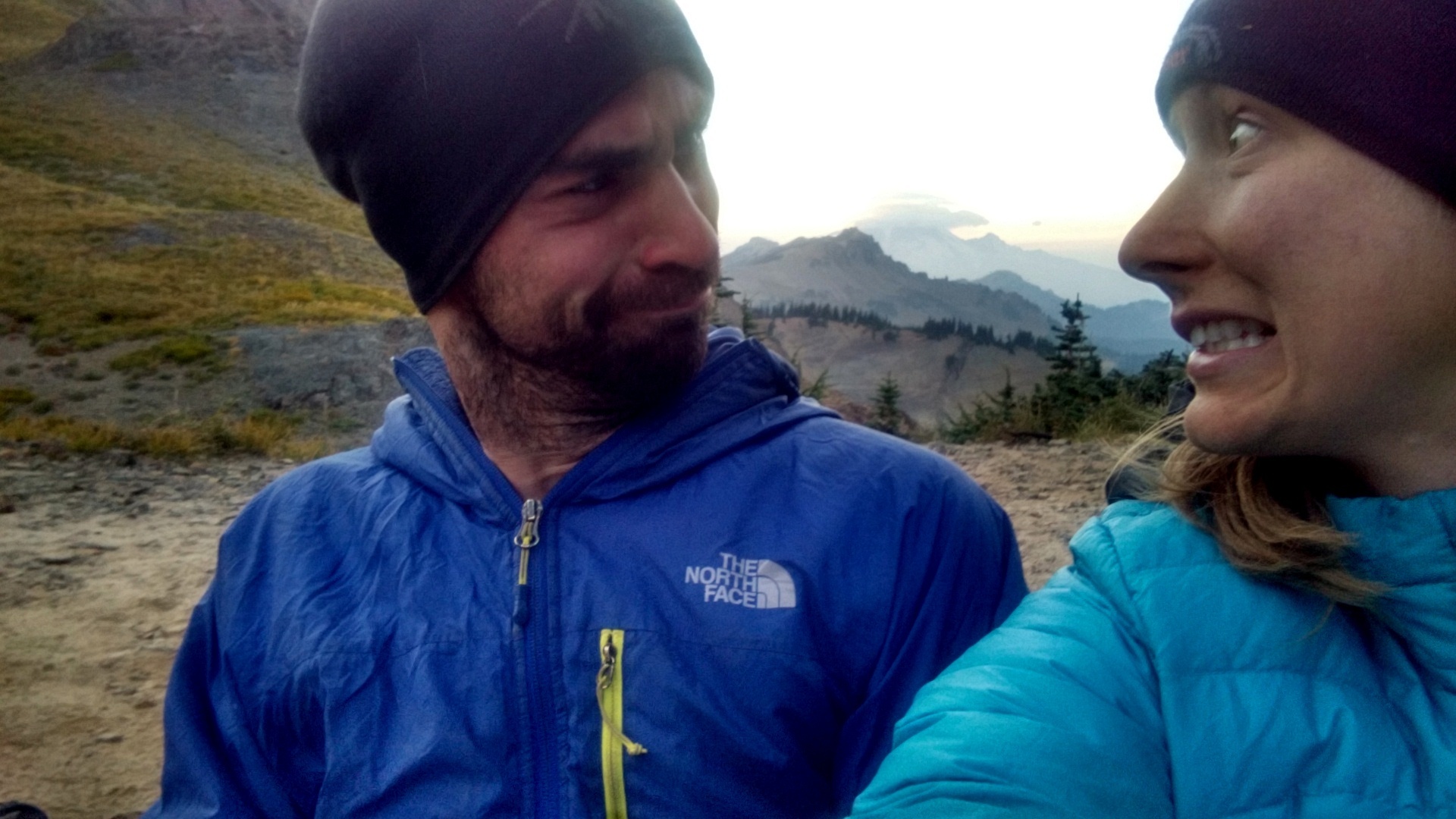
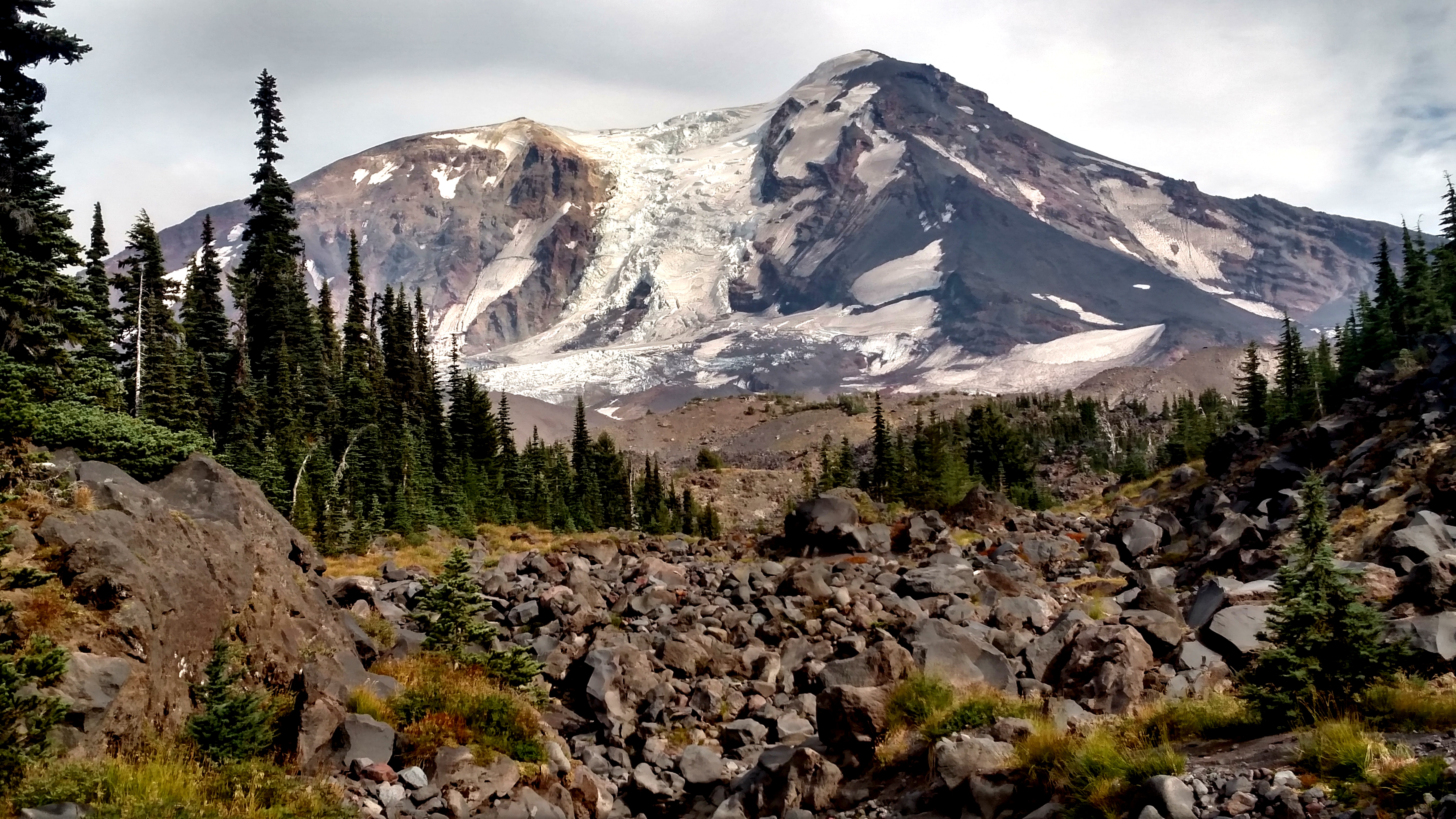
The trail then enters the Mount Adams Wilderness, where it traverses around the western flank of the 12,276 ft. volcano. We were forced to evacuate this area due to the spread of a nearby wildfire (more on that below), but not before our hike around the base of the mountain provided us with endless views of its many stunning glaciers. For me, this is when the trail began to reveal its true beauty and it dawned on me how spectacular the Washington section of the PCT really is. Although I have hiked in many beautiful places around the world, I can honestly say that Washington’s wild areas rival, if not exceed, the beauty of more famous regions like the Swiss Alps and the Sierra Nevada mountains.
Although we have been out of contact with the rest of the world for the last ten days, most of you have probably had access to news reports over the past weeks and are therefore well aware that the Okanogan Complex is the largest wildfire in our state’s history. The Chelan Complex is also devastating the northern regions, and will likely pose a threat to our ability to finish our hike as we travel further north. But while it’s understandable that most Washingtonians are focused on the flames up north, many may not realize that a lesser-known (and admittedly much smaller) wildfire is currently burning on the flanks of Mount Adams in southern Washington. This fire, called the Mount Adams or Cougar Creek Fire, has played a central role in shaping our hike over the past weeks.
 After we had hiked roughly ten miles into the Mount Adams Wilderness, we arrived at a wonderful campsite near a mountain lake and were happy to call it a day. Just as the dogs jumped gleefully into the lake and we began to settle in for the night, a Forest Service ranger approached us and informed us that the winds had shifted and we had to evacuate the area—immediately. We reluctantly hiked an additional seven miles, exiting the PCT on a climber’s trail.
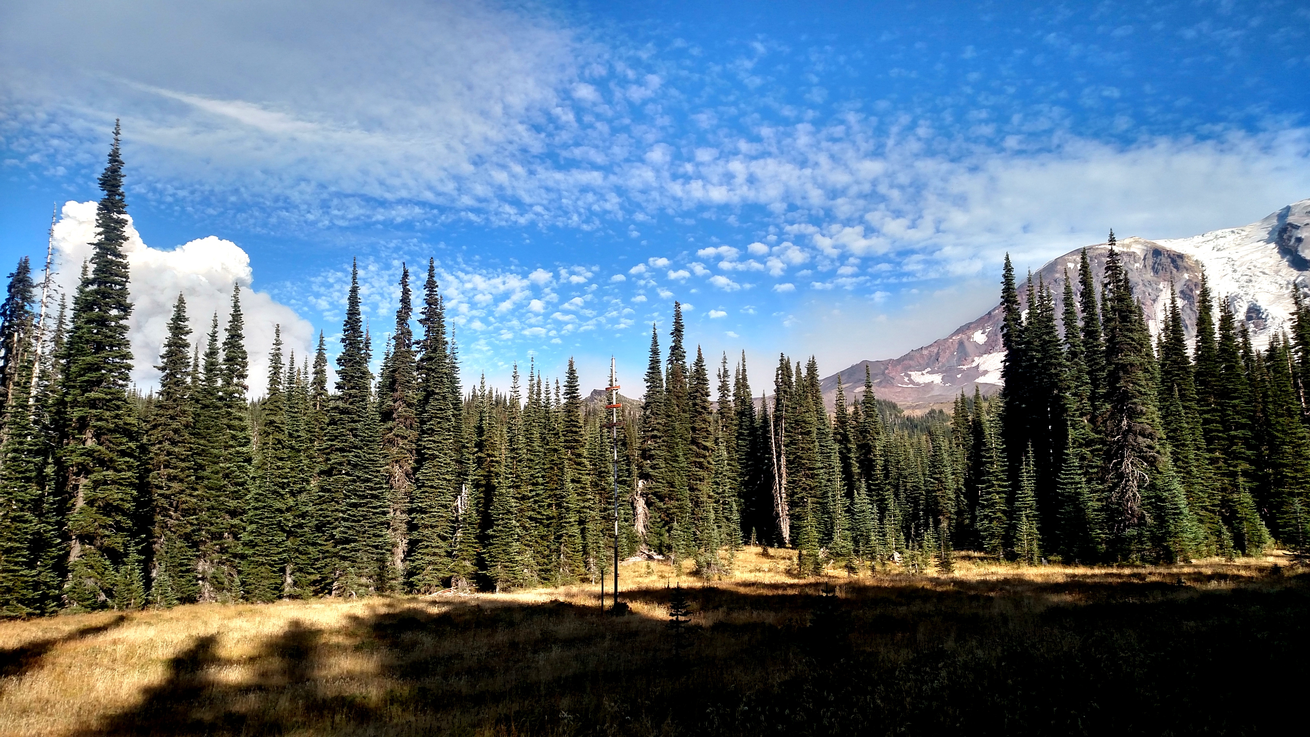
Thankfully, our trail angels (a.k.a. mom and dad) shuttled us to a trailhead ten miles up the road, and we were able to rejoin the PCT there. The smoke, however, gave us quite a scare the following night. The winds shifted in our direction, and we woke up to the thick smell of smoke. We contemplated hiking out in the dark using our headlamps to guide us, but ultimately decided to wait until morning. Luckily, the winds changed directions again and although the ash from the fire sprinkled down on us as we hiked the following day, the air soon cleared as we hiked deeper into the Goat Rocks Wilderness.
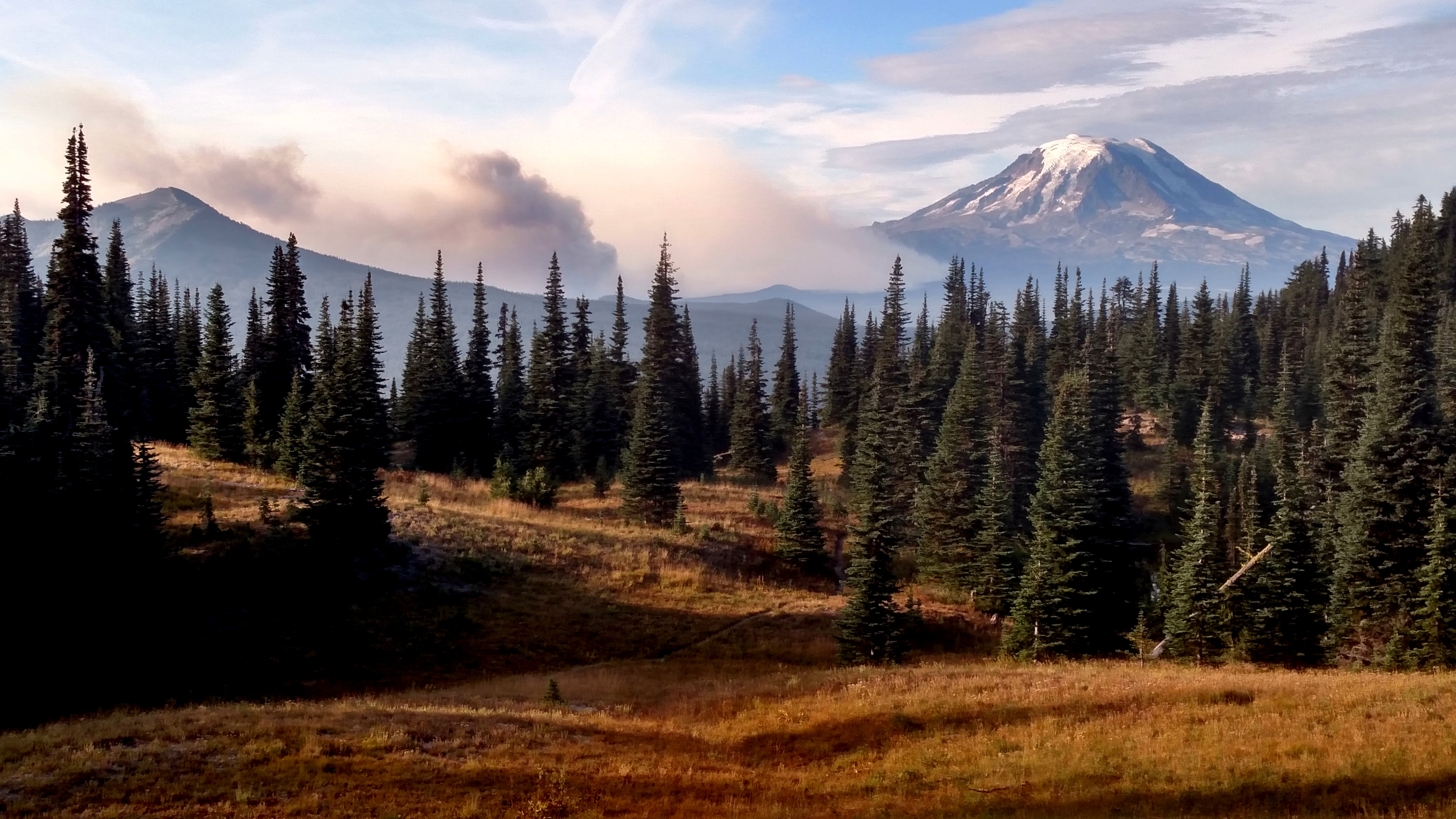
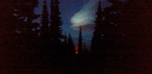
At our next campsite along the shores of Sheep Lake (one of several bearing that name), I happened to wake up in the middle of the night and notice something glowing red in the distance. Though Nathan captured a much more stunning photograph using the nighttime setting on the GoPro (which I will post once I learn how to use the silly thing), I managed to take the following picture of the flames burning behind us.
The Goat Rocks Wilderness quickly became my favorite part of our journey so far. Its jagged, glacier covered peaks stand in stark contrast to its lush, river-filled valleys.
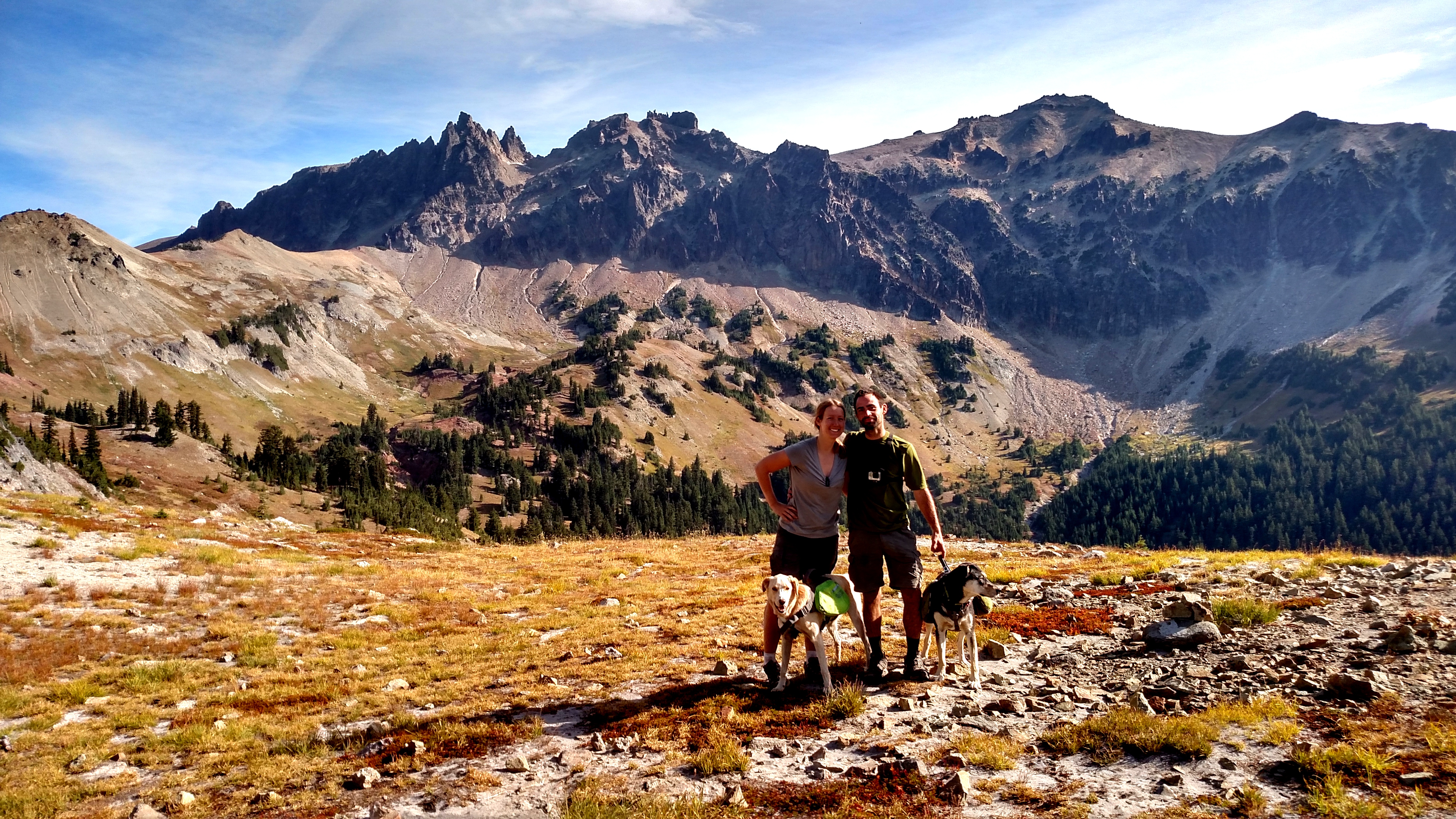
It was in this section that we crossed our first high mountain passes and traversed cautiously along the infamous “Knife’s Edge,” which is regarded as the most treacherous section of the entire PCT. And while pictures cannot do it justice, the images below should give you a pretty clear idea why. The Knife’s Edge, formally called Egg Butte, is a part of the trail that traverses the crest of a narrow ridgeline with thousand-foot drops on either side. Although the views of the adjacent Old Snowy Mountain, McCall Glacier, and nearby Mountain Rainier were breathtaking, I was hesitant to take too many pictures for fear of plummeting to my death. One author provides the following description of the Knife’s Edge:
“[It] is a perfect example of th[e] stunning union of beauty and death, a slender crest trail carved literally on the edge of a knifelike escarpment, where the eye dances from one distant horizon to the other and the foot fears even the smallest of missteps, which would lead to certain death.”[1]
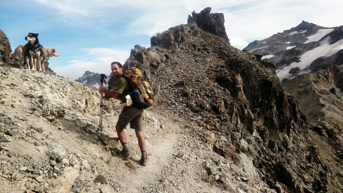

In the middle picture above, Nathan and the dogs are standing on a relatively wide section of the Knife’s Edge. To the right, you can see the trail zigzagging behind him.
Aft er hours of slowly navigating through the Knife’s Edge and descending to a lower (and safer) elevation, we found the most perfect campsite—something right out of Backpacker Magazine. With incredible views of the sunset over Mount Rainier, we decided to “Cowboy Camp,” which in trail talk means sleeping tent-free under the stars.
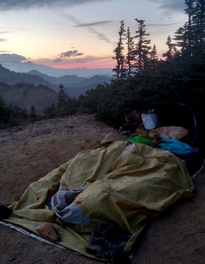
Unfortunately, the weather soon turned and we awoke in the middle of the night to strong gusts of wind and raindrops beginning to fall. We hurriedly set up our tent, and remained awake much of the night praying that the wind battering our tent wouldn’t blow us over the edge of the nearby cliff (I’m sure that wasn’t actually a possibility, but it was disconcerting nonetheless). At first light, we packed up as fast as our cold, frozen hands would allow and headed down the mountain.
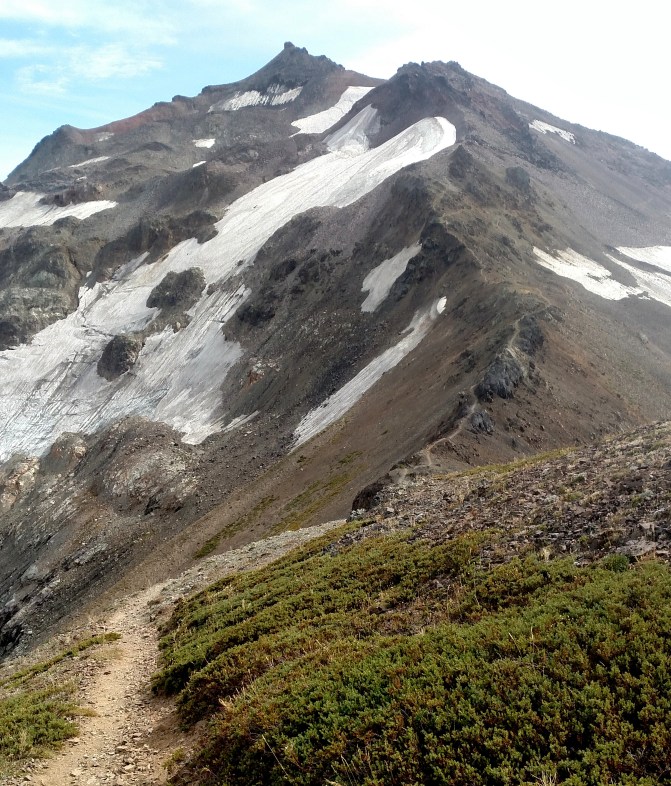
Although the Knife’s Edge was precarious on a clear, sunny day, I felt terrible for the hikers who were forced to cross after us. The image below, taken the following day, shows much of the Knife’s Edge engulfed by clouds.
 We spoke with one hiker who said that when he traversed the ridge the next day, he was certain he would freeze to death on the crest while waiting for the storm to pass (though he obviously managed to survive just fine, he was understandably disappointed to have missed the views).
After an 18 mile hike the next day, we arrived at White Pass, where the trail crosses Highway 12. Our trail angels were kind enough to hike in the last two miles and carry our packs the rest of the way. And we’re so glad they did. We needed to rest after our first ten days on the trail.
[1] Rees Huges & Corey Lewis, The Pacific Crest Trailside Reader: California, Oregon & Washington (Mountaineers Press 2011)

Wow, sounds like it’s been a little hairy! I’m so glad you took the time to post the amazing, beautiful pictures and some updates! It makes us a jealous, but we were a little worried about you with all the wildfires, so I’m glad to hear how you’ve been faring. How are the pups holding up? What did you end up doing for food for them?
LikeLike
Woo-hoo! I’m so amazed by your hike. I’m currently reading Wild, and now I’m thinking of you when I read it (even if you are on a different section of the trail). Thanks for sharing, Marie!
LikeLike
Love it Marie! Have a great time and be safe!!
LikeLike